Paul & Ellen Martin
August 12, 1989
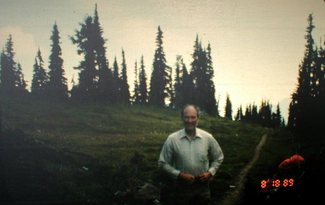
DAY FOUR
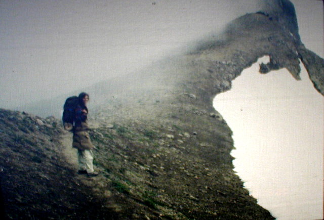
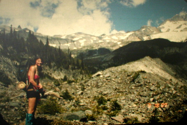
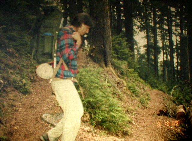
The rain quit early in the night so by morning, our equipment was pretty dry. After breakfast, we headed up the trail toward Panhandle Gap. This is the highest point on the Wonderland Trail at 6750 feet. It is on the same ridge, only lower, as Little Tahoma. Little Tahoma is the prominent bump on the left side of Mount Rainier as you view it from Seattle.
The higher we went on the trail, the bleaker it got and the bigger and more frequent the snowfields got. Where the snowfields were especially steep and dangerous, here were freshly cut steps that made the going relatively easy and safe. We couldn't get over how much work that little ranger had done the night before in the rain cutting these steps. There must have been a couple hundred yards of them all the way to the gap.
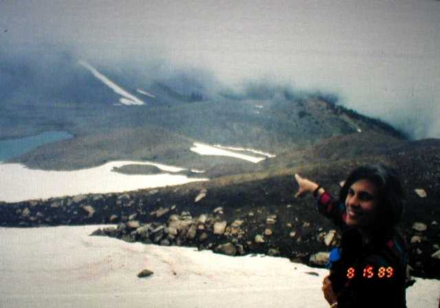
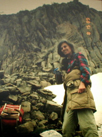
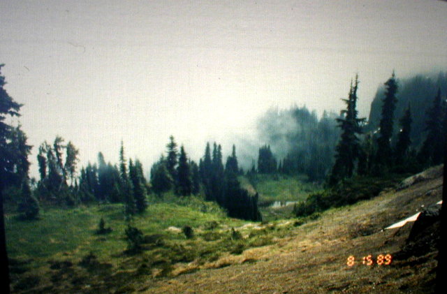
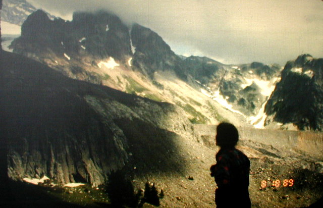
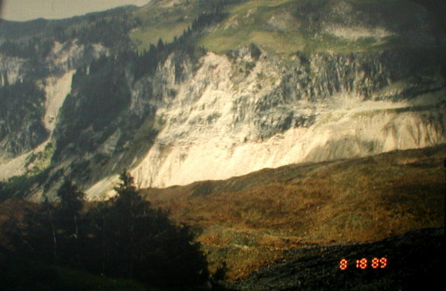
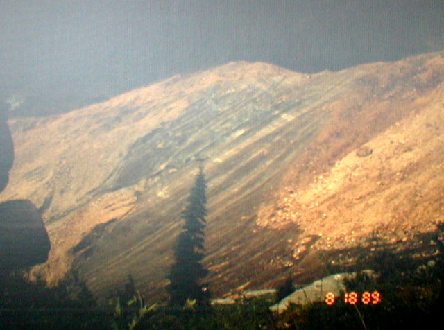
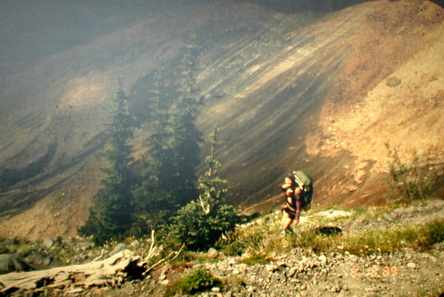
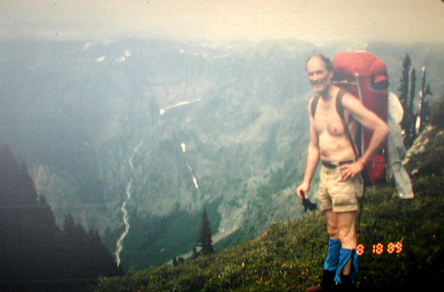
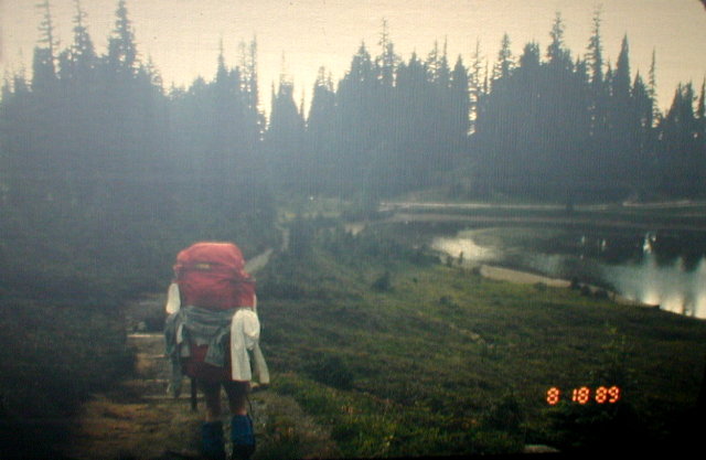
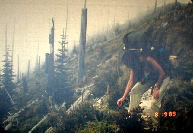
The rain had stopped, but unfortunately there was a thick fog. This was bad timing because this day's hike would mostly be along the Cowlitz Divide which is a high ridge offering splendid views both to the east and to the west - on a clear day. Unfortunately for us, we could only see a few hundred feet around us because of the fog.
This made it seem like we were on another planet. There was hardly any vegetation up there. Just rocks and snow and fog. This is where we would have had to camp if we had stuck to our original assignment. It made us appreciate the ranger camp all the more.
At one point up there, we saw a ptarmigan sitting in the rocks in the fog. It was so camouflaged that we didn't notice it at first. We got a picture of it and it is somewhat of a challenge to find the bird in the picture.
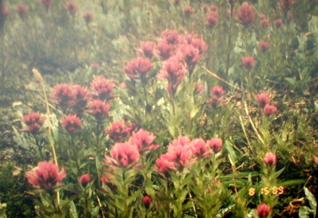
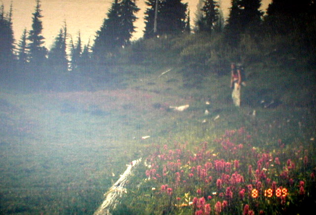
In spite of the lack of a view, we were rewarded by seeing lots of beautiful flowers. Indian paintbrushes brightened up the desolation and the puffy white beargrass blooms arranged themselves among the smaller, brighter flowers.
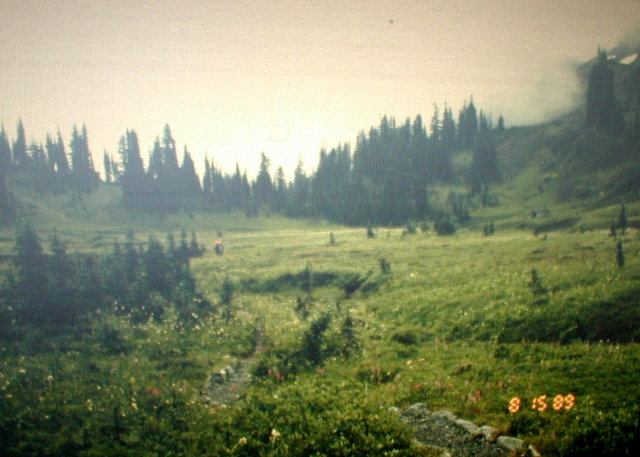
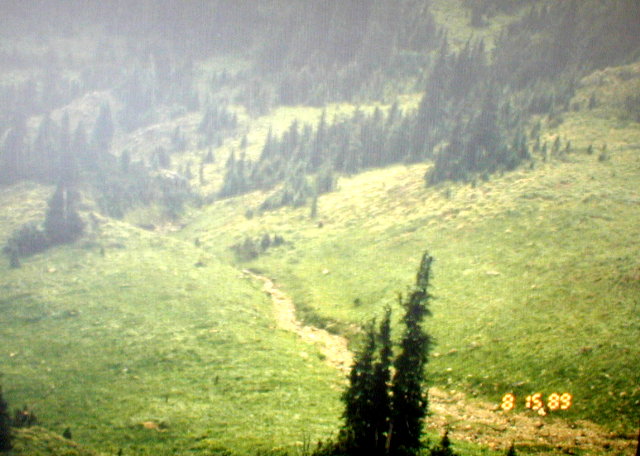
After a couple miles, we dropped down into Indian Bar. This is a beautiful valley with deep green meadows and fields of wildflowers. It was also below the fog so the views were especially delightful to us as we dropped the 1650 feet to get to the Indian Bar shelter. It was occupied, so we had our lunch on a bridge over a pretty little gorge.
After lunch, we started the 850 foot climb back out of Indian Bar and up onto the Cowlitz Divide. Back into the fog. It was a little thinner than it had been, but there were still no views of the distance. For the rest of the day, the trail was fairly steady downhill for 2570 feet. This makes it fairly easy from an oxygen and energy point of view, but it is a lot harder on the feet. We both got pretty tired and footsore by the end of the day.
Soon after the high point of the divide, Ellen thought she saw a marmot out of the corner of her eye. The trail was just to the left of the crest of the divide at that point so you couldn't see over it. Ellen hurried ahead a little bit to where she could see over the divide to see if she could see her "marmot".
What she saw was a black bear running down the slope on the other side of the divide. We got some pictures of him in the distance, but we couldn't believe how fast he loped down the slope to the bottom of the valley, and then up the other side. He just bounded along taking these enormous strides. We were glad he wasn't interested in chasing after us.
The trail gradually gets steeper as it switchbacks off the divide and descends into the Nickel Creek Campground. This was our destination for the evening and this was Ellen's hardest end of day hike; by the end of the day, her knees were beginning to hurt. It seemed that the last half hour of each day's hike was the hardest and on this day, Ellen looked like I had felt going into the campground at Sunrise two days earlier.
When we got to the Nickel Creek Campground, there were plenty of unoccupied sites. In particular, there was a big unoccupied group site. Since it was fairly late, and, after all we were a "group" of two, we decided to take the group site. Here were quite a few amenities, including a three sided log shelter. The shelter had a big wooden sleeping platform against the back wall so we figured we could save the trouble of setting up the tent and packing it back up in the morning.
When we were fixing our dinner, we discovered we were sharing the place with its permanent resident - a friendly little kangaroo mouse. He had these big hind legs and he hopped all over our kitchen while we fixed dinner. Of course, we had to share our dinner with him.
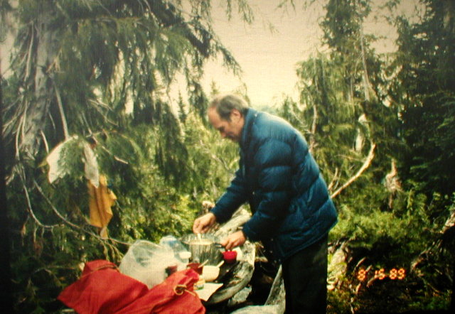
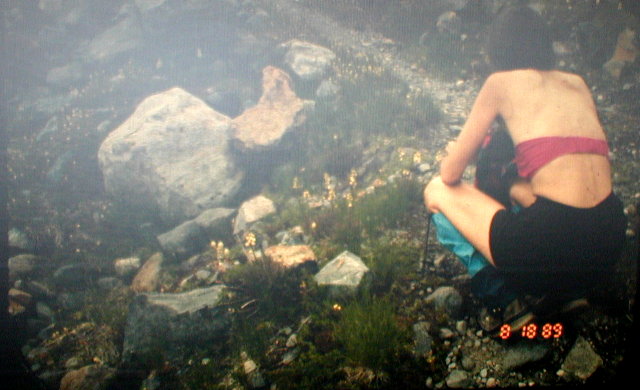
Part of each evening's routine was getting water for dinner and also for the next day's hike. Our filter pump worked great for that. We would just find a reasonably clear source of water and then just stick the pump's hose in the water and pump good filtered water directly into our water bottles. The pump can handle very muddy or brackish water but we were always able to find relatively clear water to use. This kept the filter nice and clean so we didn't have to clean it during the whole trip.
This was the first camp where we had any kind of reasonable furniture to sit on and I appreciated the log bench we had. Unfortunately, sitting caused my back to hurt so this was the only place my back hurt during the whole trip. I did too much sitting.
When we rolled our sleeping bags out on the sleeping platform, we had a choice of having our heads next to the back wall or near the edge of the platform in the middle of the shelter. I can't remember why, but we decided on the back wall.
It was dark when we climbed into our sleeping bags and got all cozy. As I was snuggling in, my hand touched something cold, and soft, and wet and on the outside of my sleeping bag. My first thoughts were "Oh Shoot, I have laid my bag over some animal's poop". I kept my hand on (in) it so I wouldn't lose it or smear it around any more than it was, and I said to Ellen, "Quick, get the flashlight and shine it on my hand. There's something all over my sleeping bag."
When the flashlight beam followed my arm down to my hand, it showed that I was holding a big green slug. My arm jerked by reflex and I threw the thing out of the shelter and we both shuddered.
We shined the light on the wall and we could see more slugs coming in for the party. That changed our minds and we turned our sleeping bags so our feet were toward the wall.
We no sooner got cozy again and were laying quietly than our friendly mouse, or one of his relatives, ran right across my face. That did it.
We got up and I pitched the tent right on the platform and we moved into it. We figured the animals would still be crawling all over the tent, but they wouldn't be able to get in through the screens and zippers. The rest of the night was uneventful.
DAY FIVE
According to the book, this day's hike was supposed to be the worst because it goes mostly uphill all the way to Paradise at the bottom of the Stevens Canyon. Here you hear the constant noise of the traffic from the road on the opposite side of the canyon, and it is usually very hot.
For us it wasn't too bad because the weather was still kind of cool with even a slight drizzle now and then. We didn't have to use our rain gear but we kept pretty cool.
Just a short distance from Nickel Creek, the trail crosses the road at Box Canyon. This is one of our favorite places to visit and it is one of the places where the Wonderland Trail meets with civilization.
After Box Canyon, the trail enters the Stevens Canyon and we didn't see another person, except across the valley in their cars, until we got up to Reflection Lake at the top of the canyon. Since there is not much traffic on this stretch, the brush was overgrown quite a bit and since the weather was damp, the bushes were wet and we had trouble keeping our boots dry.
As I mentioned before, our packs were pretty light because we had almost no food left at this point except for staples and trail mix. This was by design and it made the hike seem pretty easy.
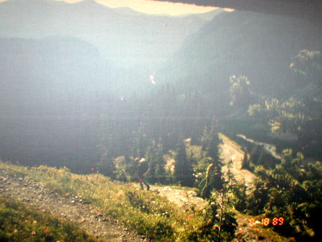
At the top of the canyon, we reached Louise Lake. Then a little farther on, we walked along the road on the shore of Reflection Lake. This a pretty popular place for photographing Mount Rainier and its reflection in the lake.
At the west end of the lake, we turned right and left the Wonderland Trail and took the trail heading to Paradise. We knew we had a bed, a shower, and a couple of restaurant meals waiting for us so we were eager to get there.
Again, the last half mile seemed like forever. The signs in that area are marked in kilometers instead of miles so we weren't really sure how far we had to go. We didn't know exactly how, and anyway we were too tired, to convert kilometers to miles so we just kept trudging on in our wet boots thinking the lodge would be just around the next corner or just over the next rise.
The lodge did finally surprise us by suddenly appearing in front of us as we came over a rise. What a sight. It seemed enormous looming above us and as we approached it on the tidy little gravel paths, we saw the tourists casually strolling about in their comfortable clothes. I hadn't shaved for the whole trip and I think we looked pretty grubby after five days without a shower.
They made us feel good when we checked in because they are used to hikers mixed in with their other guests and we seemed to get a little respect and attention from most of the people as we carried our packs through the lobby and up to our room.
We had a tiny little room, but to us, Paradise was indeed the correct name for the place. The first thing we did was to hang our gear all over the room. Our boots and socks were wet and our sleeping bags and tent were kind of wet. There were some fairly hot steam pipes in our room and they provided a great place to dry the stuff.
We were hungry and we had already asked the people downstairs if they minded serving us before we showered. They said absolutely not and they welcomed us down. So we just washed our hands and faces and went down to eat. What a treat.
The food was delicious and it felt so good to sit at a table and be served.
After dinner, we showered and hit the sack. Paradise again.
DAY SIX
We overslept a little and got started later than we planned, but what the heck. We had a great breakfast in the inn, and then got back on the trail.
Ellen had to do some navigating for us to find our way out of there because the trail crosses the highway several times and it isn't always easy to figure out where the trail resumes on the other side of the road. On one of these, in particular, I took the wrong trail for quite a ways before Ellen found the right one back in the other direction.
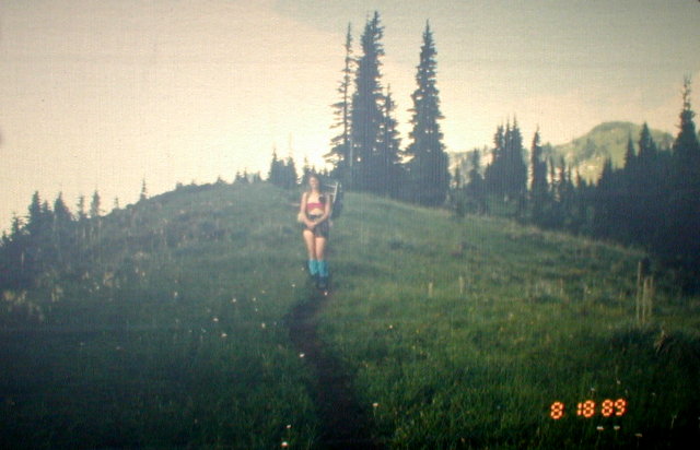
The weather was clear and beautiful, our packs were still at their lightest, we were well rested, and by now pretty well conditioned to hiking. The trail downhill to Longmire was delightful.
We joined the tourists on their hundred yard hike down to view Narada Falls, but we kept going by ourselves after taking pictures as the tourists turned around to go back to their cars.
The trail brought us to the Cougar Rock Campground and from there we followed the Paradise River to Longmire.
We got to Longmire just in time for lunch. The only food for sale in Longmire was hot dogs from a stand because the lodge was under construction at that time. We had a nice lunch and then we went to the hiker's center to get our cached food - and to check on the bridge over the South Mowich.
We had cached 12 lbs. of food at Longmire so it made our packs noticeably heavier when we loaded it up. We discovered that we had overestimated the amount of fuel we needed. We had carried two bottles with us and we had stored an additional two bottles with the ranger at Longmire.
By this time, we had used a little over half a bottle. So instead of picking up additional fuel, as we had planned, we dropped off some. We left the partial bottle and only took one full bottle with us.
When we asked the rangers about the South Mowich bridge, they said they didn't know but they got on the radio to the Mowich ranger station. We waited for the answer, and the answer was that the bridge still wasn't fixed. Now we started to get a little concerned. They did reassure us though that they did get a log across the main channel. Oh, well, they still had a couple days.
We left Longmire heading up the Rampart Ridge trail. Ellen and I had taken this trail to Indian Henry's Hunting ground the year before so we were familiar with it. After dropping 400 feet, the trail gains 1280 feet in two miles to Rampart Ridge. From there it drops 560 feet to cross Kautz Creek. Kautz Creek is milky white glacial water and near the bridge, there were two very overweight women hikers with lawn chairs strapped to their packs. They were getting water out of some muddy looking puddles in the gravel. It seemed strange to us because there were some nice clear streams nearby that looked like a lot better water source.
After crossing the creek, the trail climbs back up 1280 feet to Devil's Dream Creek campground. This campground was where we stayed the year before but it was full this time and we had to go another 600 feet up to Indian Henry's Hunting ground. We decided to get water at Devil's Dream because someone told us there was no water beyond for a long way.
We even had trouble finding water at Devil's Dream and had to hike quite a ways back down the trail to find any. We met some people getting water who were camping at Devil's Dream and who we encountered several times later on. They were also hiking the entire Wonderland Trail.
The last half mile to Indian Henry's was the same as the rest - long and tiring and I thought we would never get there. When we finally did, we had to leave the trail and find a spot a half a mile away. I think we cheated a little and didn't quite go the full half mile. We were tired.
That wasn't the worst of it though. When we took our packs off and started to set up camp, we discovered we were in mosquito heaven (or hell). They were thick. As usual, we put on our hats and coats and long pants for protection but they still got us. We prepared our dinner and ate as quickly as we could and got into the tent to get away from the mosquitos. We thought maybe they wouldn't be so bad in the morning so we went to sleep early.
There was one thing I remember about the dinner that evening. We had some freeze dried stuff that was labeled "Apple Crisp" (Alpine Aire) that was on the menu. We added the boiling water as per the recipe and were unpleasantly surprised when we tasted it. It bore no resemblance to apple crisp. Instead, it tasted like bland oatmeal with no salt or sugar. It was pretty awful.
DAY SEVEN
I don't think the mosquitos slept at all and they were all still there to greet us when we awoke. We decided to skip breakfast and get out of there as quickly as we could. We planned to find a nice place to eat later on that didn't have so many bugs.
The trail was still going uphill and we discovered how important it is to have food in your body while you are hiking. We both felt weaker than we should and we realized it was because we were hungry. There were still a lot of bugs on the trail but it didn't look like there were going to be any flat spots, so we just decided to stop and have breakfast on the trail. The trail had sort of steps made out of logs at that point so we just sat on the steps and fired up the stove. We had our usual coffee, oatmeal, and granola. We felt a lot better after that.
In a little ways, we reached Indian Henry's. It is a beautiful area. Light green meadows with patches of snow and little clear pools that reflect the magnificent views. There is a little cabin there and we went over to it to read the messages the rangers post on the bulletin board. There we met and talked with another hiker.
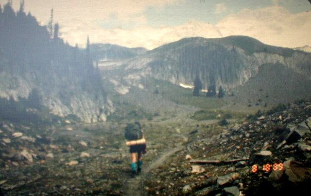
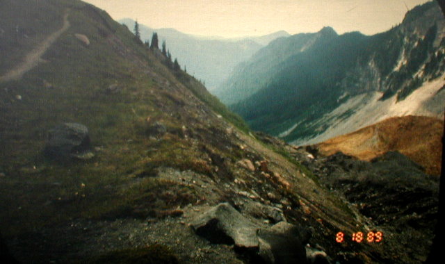
From here, the trail drops 1200 feet into the Tahoma Creek valley. A long, high swinging suspension bridge crosses a deep gorge to the other side. Some hikers we met earlier said that some people are so afraid to cross this bridge that they turn around and go back. That would have been out of the question for us at this point. The bridge was kind of scarey to cross.
On the other side of Tahoma Creek, the trail traverses up the side of Emerald Ridge. On the way, we got spectacular views of the Tahoma Glacier and the South Tahoma Glacier with Glacier Island in between them. Glacier Island is a sheer rock cliff sticking out of the ice and the top of the island looks like alpine meadows and trees. It looks like the only way to get up there is by parachute.
On the way to the top of Emerald Ridge, we passed a field of rocks with marmots. We stopped and talked with one for quite a while trying to coax him out of his hole. No luck.
At the top of the ridge, we looked back and we could see the marmots running around the little trail we had just been on.
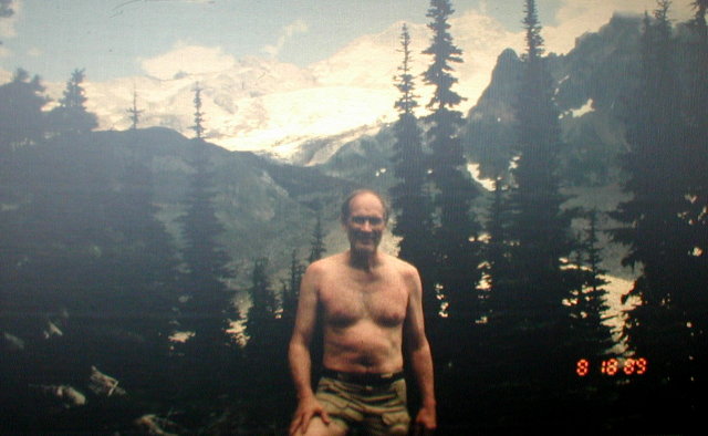
As we crossed the ridge, we could see Tokaloo Rock and we could look down on the Tahoma Glacier and the valley it is carving out. Spectacular! The ridge lives up to its name and is emerald green. It is studded with whitish rocks, and little clear reflecting pools. We both thought it was the most beautiful area on the entire trail. We took quite a few pictures up there.
Leaving the ridge, the trail follows the edge of the valley with the Tahoma glacier directly below you. It is a very steep long bank and the trail is right on the edge. It's awesome. The valley walls are sort of yellow from some sort of mineral and there are other colors mixed in with it. The glacier is black with dirt and rocks.
The snout of the glacier is a steep flat slope of ice with hundreds of rivulets running down it. As the ice melts, rocks that have been carried down on top of the glacier, let loose from the top and slide down this face. We could hear them as we were hiking and once we stopped and watched and we could see them go.
All the while we were dropping the 1640 feet to the South Puyallup River, we were looking across the glacier, across the valley knowing that we would have to climb back up the other side before we would be done for the day.
The climb up the other side was a pretty steep 2000 feet. The trail followed the crest of the ridge as it came into St. Andrews Park. Here we saw a white tee shirt in a tree. Then we saw the owner of it coming down the trail. He was a guy we had seen back in Devil's Dream campground and he had hiked on ahead of his party. We had passed them not too far back on the trail.
The guy told us that as soon as you get to the pass at St. Andrew's Park, the wind is super cold and we should put a warm shirt on. We did, but it wasn't really as cold as he led us to believe.
After St. Andrew's Park, we dropped down a little and followed a ridge to Klapatchee Park. This was our destination for the night.
There was no one in the camp when we got there so we took the very best site. In fact, it was the only really good one. It had a spectacular view of the mountain and was nice and level and big. All the others were sloping so much I think it would be hard to sleep without rolling out of your tent.
I think the other group of people regretted coming in second when they saw our campsite compared to theirs.
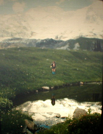
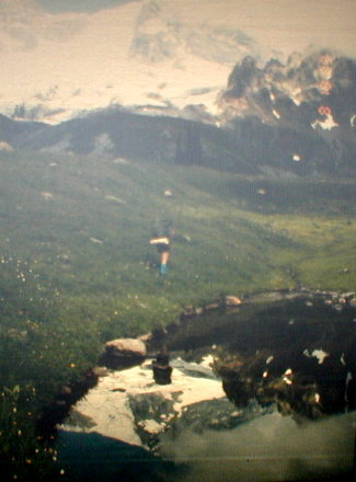
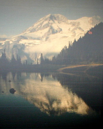
The camp is on the edge of a small lake and when the water is still and there are no clouds, it makes beautiful reflections of Mt. Rainier. The mountain was covered by clouds when we got there but when we went down to the lake to get water for dinner, the clouds had parted and there was a beautiful, clear view. I went back up to the camp and got the camera, but by the time I got back, the clouds were back.
I went back to camp and started fixing dinner. One of the guys from the other party had seen me try to get a picture so he called to me and told me that the mountain was out again. I grabbed the camera and went back down to the lake.
The clouds were changing fast and sometimes you could see the mountain and sometimes you couldn't. The wind was also changing so sometimes the lake was flat and sometimes it was full of ripples. I just sat and waited hoping I would get both a flat lake and a good view of the mountain.
I never did get a perfect shot, but I got some that were pretty good. The sun was going down so the mountain had a rich dark color.
Getting water from the lake was quite a trick. The shore was so shallow and muddy that you would stir up the bottom if you disturbed it the least little bit. There was a big rock about 10 feet from the shore and a series of smaller rocks leading out to it. We were able to get out to the big rock by hopping on the smaller ones.
It is easiest if two people get the water; one to hold the water bottle with one hand, and with the other, hold the hose in the water source without letting it hit the bottom or come up out of the water, and the other person to run the pump. Ellen and I had become a pretty good team at doing this by now but there wasn't a whole lot of room on that rock for both of us. We did the job anyway. In the process, Ellen noticed that the water was full of teeny tiny red fish (bugs?). They were too big to get through our filter, however.
It was about here that Ellen discovered a flaw in our route plan. We were planning on spending the next night in the Golden Lakes area, and the next morning meet Dave and Charis at Mowich Lake. Ellen pointed out that that would mean a nine mile hike before noon in which we would drop 2080 feet and then climb back up 2210 feet. A little much to make it before noon.
As a result of this discovery, we changed our plans and decided to hike past Golden Lakes and make our next camp destination the South Mowich Campground. That way, it would be just a 4 mile, 2210 foot uphill hike before noon. It also meant that we should leave Klapatchee Park fairly early in the morning.
DAY EIGHT
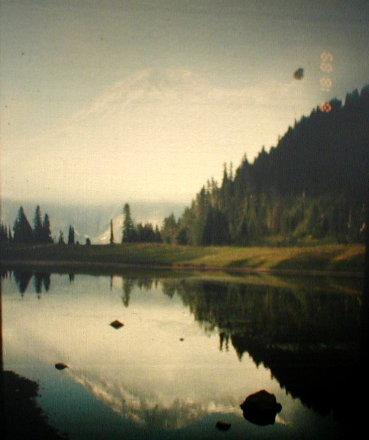
I don't think we left super early the next morning, but I do remember that the mountain looked completely different that morning. In the evening, the mountain looked warm and rich with color from the setting sun. In the morning the mountain was in the shadows and it looked cold and gray and forbidding. Quite a contrast.
From Klapatchee Park we dropped down fairly steep switchbacks to the North Puyallup River. Here the trail intersects the West Side Road at its end. We had tried to use this road a couple times in two different years and it was washed out and closed both times. That was also the case during our hike so all the access to the Wonderland Trail from the west side of the mountain was by foot only - just the way we had come. Access from the north was further limited by the South Mowich River bridge being out. As a result, there weren't a lot of people on the trail or in the camps. We just kept seeing the same party of people over and over.
From the North Puyallup River, the Wonderland Trail has its only level section. It follows a contour line almost exactly for about a mile. It seems sort of like you are going up because the trail traverses the valley and the river keeps getting further and further below you and you keep getting closer to the ridge, but the trail itself is perfectly level. It's as pleasant as walking in a city park. You can just relax and enjoy the scenery along this stretch.
At the top of the ridge is Sunset Park with the Golden Lakes just beyond that. Based on our new plan, we just kept right on going past the Golden Lakes.
The trail traverses a ridge above the Golden Lakes. In an open area that was burned off in an old forest fire, we came across a bunch of ripe huckleberries. We stopped and picked and ate a bunch of them. They were delicious.
Where the trail reaches the top of the ridge, it goes down steeply into the South Mowich River valley. Just as we got to this point, we met a guy who had just climbed out. He had counted the switchbacks and told us there were 33.
We counted the switchbacks as we descended and we came up with about the same number as the guy had told us.
The lower we went, the bigger the trees got and the deeper and darker the woods got. This is all virgin timber and the trees are massive.
All the time, of course, we are wondering what the situation will be for a bridge across the river. They should have had time to fix it, but there were no guarantees.
When we got to the river, we could see how it could have washed out a bridge. It was a raging, muddy torrent making a constant loud roar.
We walked up and down the bank looking for a way across and discovered that the river split into three channels with two gravel islands separating them. The main channel was in the middle and we could see the log across that one that the rangers had told us about.
Now the problem was how to cross the near channel to get to the first island. After scouting it out, the best way across seemed to be a fallen tree that went across the channel. There was a lot of brush around the tree and it was awkward getting over it with a pack, but we made it after taking it easy.
Now we were on the first island and we went over to the log bridge. The channel was about 40 or 50 feet wide and the muddy water was just churning and frothing. The log was about 2 feet in diameter but there was no rail except for a piece of wire stretched across posts along one side. The log sagged into the water so the waves were lapping up over it. It was a little scarey to say the least.
Again, we took it easy and we both made it across. Now we were on the second island and we had to find a way across the last channel. We took off our packs and scouted up and down the banks for a way across. We found a fairly narrow spot that had some boulders in it that we could use to step from one to the other. This worked for us, so we made it across safely.
Now the problem was to find the trail in the brush on the other side. I went upstream looking for it and Ellen went downstream. She found an outhouse which was in the South Mowich River Campground which was our destination for the night. When I came back from my search, she told me she had found it.
We walked through the camp area and found that there were three separate camp areas, each with a wooden shelter. The camps are in a pie shaped area between the North and the South Mowich Rivers. We didn't see anyone else around. We picked the middle camp area and decided not to use the shelter because of our experience at Nickel Creek and also because the shelter was pretty dusty and dirty.
In our exploration, we noticed that the best place to get water was near the third camp area so before dinner, we went up there on a water collecting expedition. On the way, we saw two teenage boys on the trail. They were wearing tennis shoes and tee shirts. They didn't seem to want to talk and they just went on their way.
Back at our camp, we saw one of the women from the same group we were with at Klapatchee Park. She wanted help in getting the rest of her group across the river. We showed her how we had done it and I guess it was the same way she found. It might have been the only way.
She told us that she was very anxious to get home and since her car was at Mowich Lake, they were just going to keep going and climb the 4 miles up to the lake. They were sure they could make it by the time it would get dark.
They left and we fixed our dinner. The two boys walked through our camp area toward the river and didn't say anything. Looking back, they acted sort of suspicious, but at the time we didn't think much of it.
After dinner, we made another water run to stock up for the next day and as we did every night, we put our food in plastic bags and strung them high up in a tree hanging from a rope. This is to keep the food out of the reach of bears and other smaller animals. And, because of the bears, we hung it up quite a ways from our tent.
Our tent was pitched pretty near the shelter, so we put our packs in the shelter in case it rained. They don't fit in our little tent with us. Since my pack was in the shelter, I didn't close it up.
By now, you probably know, or have guessed what happened.
©2002, 2003 Paul R. Martin, All rights reserved.